Thursday, November 19, 2015

autumn hike

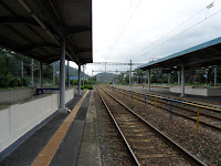
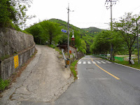
Last weekend, I went for a hike to the nearby mountains by myself, walking from home as usual, and took photos of random scenes about the changing season. The leaves have turned yellow and brown as the autumn is getting deeper. Leaves falling down scattered on the ground. Looks like this autumn there has been much more rain than the previous ones. We also had a couple of rainy days last week. It didn't rain while hiking even if it was cloudy. 

Walked along the trail for 5 hours and got to a river bank named Dalseongbo weir. Got back home after half an hour on foot and by local bus. Hiking really helps recharge one's batteries after a busy week at work.

Wednesday, November 11, 2015

Namji Bridge

A small, peaceful town, Namji 남지 in the southern province of Changnyeong 창녕 county is just by the bank of Nakdong River. Namji Bridge was built on Feb. 1933 during the Japanese occupation, which was on the road from Daegu to Masan. The photos show the view from the top of the southern mountain, which were taken by an American war correspondent on August 1950 during the Korean war and the right side one depicts the bridge to be destroyed in the same month, which was intended to stop North Korean People's Army from crossing. It has been estimated that this used to be one of the most major and beautiful iron bridges in the peninsular. Plus, it was built by using new construction techniques as applied to Eiffel Tower in Paris. The tiny northern village across the river is Namji.

The areas around Namji Bridge were prone to floods. In the summer of the year 1933, the flood struck the northern villages and thousands of villagers had to evacuate to the nearby mountains during midnight. The road linked to the bridge was also washed away, so it had been completely closed off to the traffic for two months in the same year as the completion of the bridge construction. This bridge had been used for pedestrians and vehicles until 1994. Now it is only opened for the pedestrians. In 1977, a new bridge for the expressway from Daegu to Masan was constructed nearby. 
These photos show the recent images of the bridge last summer. The top is the southern entrance to the bridge. The mountain on the right side is the spot where the American war correspondent took the photo of Namji Bridge about 65 years ago during the war.

Saturday, August 08, 2015

Confluence of Rivers


A little town named Samnangjin 삼랑진 is around the confluence of two rivers,  the Nakdong river 낙동강 and the Miryang river 밀양강. Samnangjin means a river dock where choppy water fed by three tributaries flows over the surface. Since Shilla dynasty(57~935 AD), a river dock located here had actually played a principal role in water transportation route along the Nakdong river. It became later one of the biggest dock along the Nakdong river during Joseon Dynasty(1392~1910 AD) whose role was more emphasized as a collecting center for taxes, and it had a prosperous period in its history. The tax was usually paid in grain, cotton cloth and coin. In 1765, a tax warehouse named Jochang 조창 was opened on the riverside at the confluence to store the collected taxes from 6 regions including Miryang, Gimhae 김해, and Hyeonpung 현풍. Jochang refers to a warehouse for taxes arrived by ships. This route was linked to Samunjin 사문진 and Gangchang 강창 river docks.
A railway station was opened 3 km inland northeast from Jochang in 1905. Since overland traffic was introduced, water transportation route had decayed. Jochang was closed, cherishing old memories and the town center was newly moved to Songji 송지 nearby where a railway station was built. However, Samnangjin had flourished again since the railway station became a junction which is connected to Seoul 서울, Busan 부산 and Masan 마산. 
During the Japanese colonial period, Samnangjin railway station had a big official residence for railway workers, which still remains partly renovated on the gentle slope to the north of the station. The residence is on the unique wall made of stone and cement that can be easily found in the typical Japanese castle architecture.
Meanwhile, since the first track had been partly relocated, the single-track bridge named Samnangjin bridge near Jochang was abandoned. Now it is still one-way car traffic or used by cyclists. It was nicknamed "Bridge on the River Kwai" in Thailand. Old rusty iron railway bridge is often called like that in Korea.
Samnangjin was also located on the key walking route to Seoul and Busan during Joseon Dynasty. The trail still remains partly on the steep mountain slope by Nakdong river, which is called Jando 잔도. There is a bike trail built right out over the water.

Thursday, July 02, 2015

Where Old Memories Flow

The Nakdong 낙동강 and the Geumho 금호강, meet around Hwawon resort. The smaller one, Geumho flows into Nakdong, the longest river in the southern peninsula. Shincheon 신천, the urban stream in Daegu is a branch of the Geumho river.
The Geumho river separates western Daegu from Dasa 다사 district. A bridge connects the two at Gangchang 강창 meaning a riverside storage; gang 강 is river, chang 창 storage. In Joseon Dynasty(1392~1910 AD), sea and rivers were the main routes to transport the tax collected locally to the government in Seoul. Gangchang was a riverside storage where the tax amount was stored temporarily. Tax collecting ship used to come to pick up the stored tax earlier every year. The tax was usually paid with grains of rice.
Small boats had been also operated to transport locals to the other side of the river since the ancient times. The boats had been the only way for the locals to cross the river until a new bridge named Gangchang was built in 1971. The very top photo on the left shows a ferry boat crossing the river and the other one locals joined the opening ceremony of Gangchang bridge to celebrate.
The first bridge is not here any longer and has been expanded and renovated twice since 1971. The above ones are views of the present bridge opened in 2009, which has ten lanes. Gangchang used to be a typical countryside as the other villages around the city. It had peaceful scenery along the stretch of riverside with sands and tall trees, and traditional houses were scattered here and there along the dusty road. As urbanization occurred, however, the landscape is not just as it was in the past. Only the nearby mountains look the same as past.

Monday, June 08, 2015

Blue Trail

The eastern coast of the Korean peninsula has a hiking trail covering 688 km(428 miles). Since this route offers a beautiful and peaceful view of seashore along with the blue color of East Sea, it is called Haepargang Gil 해파랑길; Hae means sea, Parang blue, Gil trail. The whole route separates into 10 sections belonging to 10 administrative regions. 
Yeongdeok 영덕 County as one of 10 sections has its coastal trail covering 62.9 km of rugged terrain along the coastline. From nearly every point on the trail, hikers are enthralled by the blue sea with the panoramic horizon. The trail passes through some rocky areas and is rugged with some steep sections. Plus it runs through peaceful and rural coastal villages and tiny harbors. Since the trail is man-made recently, not treading trodden trails for a long time, you should watch your step sometimes.
Every year in March or April, Yeongdeok holds a festival to attract tourists loving Daege(snow crab) 대게 across the nation and abroad. The above one shows the official poster for this year's festival.

Tuesday, May 19, 2015

Harbor & Backstreet

Sea view from the outer harbor of Gampo 감포 last January. Gampo is one of the major fishing harbors somewhere along the eastern coast. Squids and Octopus are the main fish species. Unique fishing gears for octopus meet the eye along the pier.
The Japanese erected a monument to celebrate the building of harbor during the colonial age. It has been neglected at the corner since independence. Gampo is surrounded by hills, so most of the dwellings are nestled in the hillside slopes. Tourists can picture this public bathhouse flourished for a while. The tall chimney and steam sign drawn on it was once the typical scene to attract customers attention. The right one is seen from behind. Already closed down.
Shops are lined up along the street in front of the public bathhouse. The other one shows the locked door of the nearby old mill. The backstreet of Gampo affords us glimpses into the ordinary lives of villagers along with the remains of the colonial age.

Monday, April 27, 2015

Winggye Trail

Winggye 윙계 is the name of side valley in the southern mountain area in Daegu 대구Winggye means a valley on the left side; wing means "left", a dialect of wen 왼 and gye "valley." On the way to Jeongdae-ri 정대리, a remote village at the bottom end of the main valley, the road branches off to the left and gets narrower, finally turning into a mountain trail that becomes a little vague. The locals in the past when the public transportation was not available used to walk along this trail in the middle of this valley. The above photo was taken on May last year at the entrance of Winggye, the below ones at the same place and around the valley this spring.

This walking trail connected western Daegu and southern regions like Cheongdo 청도 and Miryang 밀양Since this area is surrounded by mountains, the ancient people traveling through this region seem to choose the lowest pass along the ridge. Winggye is really the finest choice for them to cross this mountain area. Old villagers having lived around here for several decades remember that up until then, this tail had been jam-packed with travelers. Since the new road was opened, it has become almost deserted. 
It was getting warmer. Cherry trees came into bloom. Winggye Jae 윙계재 is the name of the pass across the mountain ridge, between Winggye and the other side of Cheongdo province; Jae 재 means "pass." Heading southwards, the trail leads up the gentle slope and becomes steep near the ridge. Trail markers sit on the ridge pass. Four trails lead out from the pass.
Songnae 송내 is the first village that you should reach just when you go southwards down the mountain along the trail from Winggye Jae. There used to be a couple of traditional taverns for the travelers in this village who were going to cross the pass or came across it. The pavilion on the above photo behind the boulder is the site where a tavern used to be. On its left is the stone stack called Seonangdang 서낭당 that was devoted to the village guardian deity in the communal faith. Travelers used to put stones on the stack and pray for safety on the trail since they had the belief that the deity would protect them.
Looking at the mountain range from spring field in the southern district, Gakbuk 각북, you can see Winggye Jae, the lowest spot on the ridgeline in the distance. Walking along the ancient tracks trodden for thousands of years has encouraged people to contemplate life and its meaning.

Heading further southwards, you may reach a bit bigger town named Punggak 풍각. In the old days, people passing near here were likely to stop off at some inns accommodating them with a night's lodging. It takes about 7 and a half an hour on foot from western Daegu to here, but the suburban bus covers the distance within half an hour. The above photo shows that a bus for Daegu is ready to start outside of Punggak bus terminal currently under repair.