Friday, December 19, 2008

bridge & river

왜관, Waegwan, the name of the administrative district to the north of Daegu, is located next to the Nakdong River, connected by three bridges. Two bridges among them were completed by Japanese colonialists for military purposes, the older one was built in 1905. Waegwan means literally the official residence for the Japanese during Joseon dynasty. There used to be a Japanese settlement in Waegwan.

During the Korean War in the summer of 1950, the area around Waegwan was one of the most intense battlefields as Communist North Korean forces attempted to cross the river and push south through Waegwan toward Daegu. ROK and US forces formed a defensive line along the banks of the Nakdong River in order to deter the enemy's advance. Two spans of the bridges were then destroyed by an explosion ordered by a commander of the US army to prevent the suspicious refugees, believed to be North Korean soldiers disguised in civilian clothes, from crossing the river.

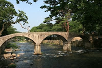
In 1953, the Korean war, the first major armed clash between the free world and communist forces ended with a truce, claiming millions of lives and causing incalculable economic and social damage. The photo shows the bridge built in 1905, which was repaired temporally and opened for public traffic after the war. It was reinforced again and reopened only for pedestrians in 1993.

Wednesday, December 10, 2008

Christianity in Daegu

After Roman Catholic was first introduced to the peninsula in 1784, Catholics were brutally prosecuted on charges of their accepting the religion of so-called western barbarians over about 100 years. In 1880th, Christians were finally legalized to share and expand their faith.

In 1903, Gyesan Cathedral 계산성당 was built as a parish church of the Daegu Archdiocese 대구 교구 and the first Gothic-style church in this region, as Catholic church began to exert its influence on Daegu and Gyeongbuk 경북 district.
A missionary named William M. Baird was dispatched to Joseon 조선 by the Northern Presbyterian Church in America in summer, 1890. He left San Francisco for Joseon with his wife, and 70 days later arrived at Busan port in late January 1891 by way of Hawaii and Japan. He stayed at Busan area about two years and preached the gospel. But he wished to spread the Good News of Jesus Christ to Gentiles in Daegu and Gyeongbuk area to the north of Busan and decided to go on a missionary trip to the region.
He began a journey on foot from Busan, went along the local roads, crossed streams and rivers sometimes and got to Cheongdo on the afternoon of April 21, 1893 and finally arrived at the southern gate of Daegu fortress one day later, which means that for the first time a Protestant missionary arrived in the area. Since then, the other Protestant missionaries had arrived, and western civilization and culture, as well as the gospel, were introduced into local people. And they opened schools and hospital as did in other areas.
Apple trees were also brought into Daegu from America and flourished quite well in the soil of Daegu region. Later Daegu got the reputation as a city of apples. The offspring of the first apple trees planted by the American missionaries is still alive on the hill behind Dongsan Medical Center founded by them. Their old-fashioned and American-style residences are also close to it and well preserved.

Above two photos represent some views of the high school established by an American missionary in 1906. Visitors can see some letters on the right side of the main entrance to the main building. The letters "헨더슨 紀念館" inscribed into granite stone indicate Henderson Memorial. Henderson was the 4'th principal of the school.
Red bricks and stones were used to build walls of a building in the school. After the Daegu fortress was broken and dismantled, a few discarded stones were recycled here.

Sunday, November 30, 2008

late autumn

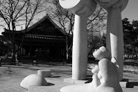
The photo at the top was taken at Gyeongsang Gamyeong Park 경상감영공원 sited in downtown Daegu. The others show Shilla tombs, Gyeongju.

Saturday, November 01, 2008

Gampo harbor

감포 Gampo is one of the administrative areas on the eastern coast of the peninsula, located to the east of Gyeongju city. It takes about 40 minutes from Gyeongju Bus Terminal to Gampo harbor by bus. Fishing was great all along the sea around Gampo, so during the colonial age, Japanese developed it as a major fishing base. Gampo is still one of the major fishing harbors along the eastern coastline. Pacific saury, anchovy, ray, sea mustard, and abalone are caught in and around the shore.

Restaurants specialized in Korean style seafood stand close together along the nearby street right next to the sea in port, and local shops and street vendors selling dried fish and seaweed are lined up along the market street. Compared to the tourist area, old Gampo(photo below) to the north of the market area offers a peaceful atmosphere. Visitors feel like that some Japanese style houses on the slope talk silently to the strangers about their forgotten past.

About 4 years ago, Gampo used to be packed with tourists on weekends who wish to taste various seafood like slices of raw fish, broth, and stew and buy seafood. But since the construction of expressway linking Daegu and Pohang was completed in 2004, the number of visitors has been considerably decreased. Since then, many tourists have crowded to the nearby big harbor, Pohang because they can shorten and save the driving time to get the eastern coast and taste the fresh seafood.

Sunday, October 05, 2008

autumn views

A Korean proverb says that during autumn the sky is high and the horses get fat. Autumn has come to the field, too. The above photo indicates the paddy field near 영해면 Yoeonghae-myeon county subdivision of 영덕군 Yeongdeok-gun County, the eastern coastal area. Yeonghae offers a panoramic view of the plain along the coast. Since the ancient times, this small town has been inhabited and regarded as a central place in remote mountain, coastal and field villages around it. So, many historical sites are scattered across this area.

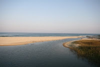
The above one shows the area where the stream near Byeonggog enters the sea. Byeonggog is at the north end of the plain, Yeonghae at the south end. A flock of seagulls are standing along or flying over the stream.
Lotus leaves and sky reflected in a pond.

Monday, September 15, 2008

story of Du Sachung

Toyotomi Hideyoshi who had unified Japan in 1590 was never satisfied with the island country and decided to begin the invasion of the continent to stabilize internal political situation after unification. Hideyoshi intended to conquer Myeong China, 명 (明, Ming in Chinese accent), thought that Joseon was not a foe worthy of his steel and requested it to allow undisturbed passage into China. Joseon was the name of Korea during the period of Joseon dynasty(AD 1392 to 1910). Joseon refused the demand totally, and Hideyoshi finally ordered to launch the invasion of Joseon. Japanese forces invaded Joseon in 1592 and battles had continued on the peninsula till 1598. Myeong Dynasty also dispatched army and navy a total strength of about 100,000 to assist Joseon while Japan invaded Joseon.

Most Koreans don't know what or who Du Sachung is, even most citizens of Daegu don't know either. But history should not be ignored or forgotten. This is the story of a foreigner who lived in Daegu in 16't century. His life was closely related to the war that Hideyoshi started on the peninsular in 16th century.

두사충, 杜思忠, Du Sachung was the name of a General from Myeong, served as a staff officer under the direction of an Admiral, and offered counsel on battle position and encampment. Actually, he was well acquainted with 풍수, Pung su (風水, Feng shui in Chinese accent), the theory of divination based on topography. 풍 Pung literally means the wind and 수 Su water. During his stay in Joseon, he distinguished himself in battles against Japanese forces and held a favorable image of Joseon called "Eastern Nation of Decorum."

When Hideyoshi died in 1598, the seven-year war also ended, resulting in numerous losses of human life and irrevocable damage to historical and cultural legacies. Troops from Japan and Myeong also returned home. But Du Sachung and his two sons didn't and decided to stay in Joseon instead. Later they became naturalized in Joseon and settled in Daegu. For his distinguished services to JoseonJoseon government donated them the land which is presently the area of Gyeongsang gamyeong.

He had also ordinary emotions and feelings like others. He longed for his country and family in Myeong when he got older. So, he made a move to the place at the foot of the southern mountain of the valley, which is presently the area of 대명동 Daemyeong Dong in Namgu district. He then named the area Daemyeong Dong meaning Great Myeong. He built an altar for the worship and on the first day of lunar month, he wore an official robe and saluted in the direction of the emperor of Myeong so far away.

After death, he was buried at the foot of a mountain which is presently near Nambu(Southern) bus terminal or Manchon subway station. When he was alive, he had already located the site where he was buried. Momyeong Jae, a traditional Korean pavilion for performing sacrificial rites for Du Sachung and his descendants can be seen on the way to his grave. Momyeong is his pen name and means longing for Myeong. His and his descendants' tombs are scattered around the nearby hill. Two stone statues of scholars, generals, and animals lined up in rows facing each other in front of two tombs symbolize that they protect the departed, which is derived from the Confucian tradition.

The photo depicts one of two stone statues of the scholar in Momyeong Jae, which was previously located in front of one of the tombs.

Wednesday, September 03, 2008

Upo

우포 Upo which is west of Changyeong county is known for swamp(wetland), which is one of Nature's treasures in Korea. The swamp would be easily accessible from all directions and the main gate is about 15 minutes drive from Changyeong Interchange. The below one shows a nearby farm road leading to the swamp.

Saturday, August 16, 2008

across the water

반야용선도, 般若龍船圖, Banya-yong-sun-do means a painting of dragon vessel of wisdom. Prajna in sanskrit or Banya means wisdom of enlightenment, yong dragon, sun vessel and do painting. So, this painting depicts the scene that a group of enlightened people sail across the suffering world toward the paradise by vessel of wisdom. Dragon-shaped vessel means wisdom to free from suffering. Two people on the prow and stern of the vessel symbolizes Bodhisattvas steering it and guiding the passengers that imply enlightened ones.
Sometimes Buddhist temples in Korea or their main halls symbolize Banyayongsun itself. When visitors look around the main gates of Buddhist temples or stylobate of the main halls, dragon, turtle or crab-shaped carving in wood and stone can be seen. The above one shows the Tongdosa version of Banyayongsundo, which was painted in 1896 on the backside of a building in Tondosa. The below one is a stone bridge near one of the main gates of the monastery.

Sunday, August 10, 2008

temple & village

This marker is designed for the visitors to the main hall of a traditional Buddhist temple established in 824 during Shilla Kingdom, 석남사 Seoknamsa well known for a monastery for Bikkhuni in sanskrit, Buddhist nuns.
Seoknamsa is one of the branch temples of Tongdosa. The mountain range with Mt. Gaji in the background contains a connected series of mountain peaks including Mt. Unmun on which Unmunsa, a major historical Buddhist monastery for Bikkhuni is located somewhere.
Summer views of traditional village near Hwawon in the eastern Daegu.

Thursday, July 31, 2008

modern history of Daegu

Daegu fortress which was constructed in 1736 and demolished in 1907, used to be in the middle of Daegu valley. At first, it was built of soil in 1590 and destroyed by Japanese invaders two years later. Historically, it was aimed to protect local people from Japanese invaders. But it was ironically destroyed by pro-Japanese district governor named 박중양, Pak Joong Yang who spoke Japanese very well. Before Japan captured Joseon in 1910, many Japanese immigrated to Daegu to make money. But they were not able to have any land and wanted to own land for business and living. Pak decided privately to dismantle the fortress to secure land for Japanese without any permission from the government. Pak was later branded as a national traitor and punished after liberation from Japan.
The fortress had the shape of a quadrangle and four big gates. A French traveler who had visited Beijing in China wrote his impression of Daegu fortress "as a miniature of the castle in Beijing, “ describing the panoramic view of picture perfect field of autumn and the nearby river from the fortress. Today the scale of the fortress can be traced through four roads that lied on the same place of the fortress after the destruction, which were named after their position as follows: Dong-sung-ro, Seosungro, Namsungro, and Buksungro. Dong, Seo, Nam, and Buk mean east, west, south, and north respectively. Sung means fortress and Ro road. The roads are together connected, forming a quadrangle with angles. The circuit of the fortress walls was about 2.65km(1.65mile) and the height 5.6m(18.35ft).
With the fortress demolished, the Japanese were permitted to start building shops and residences along both sides of the site of the former fortress. It is still easy to find many Japanese style buildings along Buksungro. Huge amounts of stone from the fortress demolished were recycled in many ways and some are still found in the forms of cornerstones of a nearby church, residences of American missionaries, and gardens. At the sites of four gates in four directions lie small stone markers.
The governor in charge of Gyeongsang district, the southeastern region of the peninsula, during Joseon dynasty resided in the Daegu fortress. 경상감영, Gyeongsang gamyeong, district governor's office and residence (color photos), was located away from the site of western gate named Dalseomun (the above photo) of the fortress. This area later became a park with the same name, well known among the locals.
A stone marker which some Chinese character is carved stands at the exit of the park. The usual transportation used by the upper class during Joseon Dynasty was the horse but some areas were allowed to ride horses only for special personnel. During the time, this park area belonged to the district governor, so the stone marker indicates that anyone below the rank of district governors must dismount from the horse before entering this area.

Sunday, June 29, 2008

Hermitage

염불암, Yeombulam, a Buddhist hermitage located on the mid-slope of Mt. Palgong surrounding northern Daegu is one of the hermitages affiliated to Donghwasa temple. Yeombul means Buddhist prayer and Am Buddhist hermitage. This hermitage was set up during Shilla Kingdom(BC 57 ∼ AD 935).
On the way to the hermitage, visitors can see two stone pillars which some Chinese characters are carved in low relief. The characters "入此門內 (on the right pillar), 莫存知解" cited from the Buddhist scripture written in Chinese mean "If you want to pass through this gate (on the right), do not give rise to thinking." "O" is also carved at the beginning of the characters, which means emptiness(공, 空). These letters can be usually found at the gates of Buddhist temples in Korea. A large rock stands in the backyard and two Buddhist images are carved on the western and southern side.

Thursday, June 12, 2008

land, sea & sky

병곡 Byeonggog on the eastern coast of the peninsula, a small harbor where very few fishing boats were anchored, used to be a simple village, but now it is known for its beach (8 km or 4.97 mile) and seashore among tourists during summer season. The above photo shows the area where the stream near Byeonggog enters the sea, and the other one the typical coastal village along the road.

Monday, June 09, 2008

mountains in the sky

지리산, Jirisan, Mt. Jiri, the biggest mountain range in South Korea and one of the favorite national parks among mountaineers is located in the mid-south region of the Korean peninsula. Many magnificent mountains, valleys and buddhist temples scatter across the park and have been historically, religiously and spiritually loved since ancient times.

On the way to 천왕봉 Cheonwang Bong, the highest peak of the mountain range, hikers can drop in 법계사 Beopgyesa, a buddhist temple which is located on the highest place in South Korea. Since the temple was first built in 544 during 신라 Silla Dynasty(BC 57∼AD 935), it had been burnt and destroyed three times by Japanese and once during the Korean war. So all of the temple and residence have been newly built except a small three story stupa, believed to be built during 고려 Goryo Dynasty (918∼1392), on the top of a rock overlooking the panoramic view of the mountain range with the temple area. The stupa has been revered by buddhists for a long time because relic of the Buddha is held in the stupa.

Lunch is offered free every saturday and sunday at the restaurant attached to the temple. 비빔밥, Bibimbab, mixed rice with vegetables as a fixed meal is served.

Tuesday, May 13, 2008

Yangdong village

It is getting more and more difficult to find the typical traditional villages in Korea as the nation become increasingly industrialized. 양동 Yangdong located about 16 km northeast of Gyeongju is a unique village where two clan families have lived together from  Joseon dynasty(1392-1910). Over 150 traditional houses mostly made of wood, straw, mud, and stone sit on a long valley and surrounding hill, offering a peaceful view of the field.
Joseon was a class society greatly influenced by Confucian ideals. Yangdong village used to be a typical settlement for the aristocratic class called 양반 Yangban, and two distinguished Confucian scholars came from here. The village has been designated by the government as Important Folk Material and three residences in the village also as national treasures.

Wednesday, April 23, 2008

Banyawol station

Japanese colonialists ruling Korea started construction of the railway linking 대구 Daegu and 영천Yeongchun in February 1916 and opened a station along the railway around 반야월 Banyawol to the east of Daegu in December 1917, which is the second stop from Daegu station. Dongchon station that was also opened in 1917 is located between Daegu and Banyawol station.
Banyawol means half moon, which was derived from the historical event that took place around Banyawol in 927. At that time, Korean peninsular was in social and political upheaval and got involved in the war, and Mt. Palgong and its vicinity became one of the major battlefields. A general called 왕건 Wanggeon had a narrow escape from death after being decisively defeated in the battle near 팔공산 Mt. Palgong and went past this area at dawn while he ran away. Then, half moon in the sky helped him find the way to escape, and he fled to Mt. Ap, Apsan in southern Daegu and found a place to hide. Later he succeeded in rising again and finally unified the peninsula. And he named this area Banyawol which had helped him run away in the moonlight.
When Banyawol and Dongchon station were closed in December 2005, it has been 92 years since the opening in 1917. The railway line along Banyawol and Dongchon was moved to the southern area due to the urban development project. But the two stations were designated as culture properties to be conserved well by concerned government authority.

Tuesday, April 15, 2008

two puppies

When I passed by a cottage on the mountain last sunday and found two dogs, one of them was rushing toward me with wagging his tail and the other one barking at me. The white one was very friendly with people and jumped on me with muddy paws. But the other one looked scared and was still barking.

Then, their owner came out and saw the scene, and we exchanged greetings. He worked nearby and smiled, told me the white dog is friendly to people, even strangers. The dog looked less than one year old.

Wednesday, April 09, 2008

Seon Master

Songchol Sunim 성철스님(1912-1993)  is one of great Seon Masters of the 20th century in Korea. It was well known in Korea that he had been a living Buddha because he had lived an extremely ascetic lifestyle and practiced meditation very strictly. He has been estimated to show the true character of the spiritual seeker as a Buddhist monk.

The above photo shows a small temple attached to 파계사 Pagyesa temple on the foot of Mt. Palgong outside of northern Daegu, in which he had stayed from 1956 to 1963 for practicing meditation without leaving there. Gomusin( rubber shoes) is one of his only mementos including socks, wood staff, rugged clothes which he had worn for 40 years and glasses. All these photos were taken outside of the temple or in the legacy pavilion built near his birthplace in Sancheong-gun(county) in Gyeongsangnam-do(province).

Tuesday, March 18, 2008

spring scenes

Green barley field and mountains around Hyeonpung 현풍, a county subdivision of Dalseong District. Spring has come to 비슬산, Bisulsan, Mt. Bisul in the middle of the mountain range, too. The ruins of 대견사, Dagyeonsa, a Buddhist temple built during Shilla Kingdom(57 BC∼AD 935)are located somewhere on the ridge of Mt. Bisul . Also somewhere nearby is an old stupa on the top of rock. Two peaks of Mt. Ap just outside of southern Daegu and Mt. Bisul are connected by a long ridge. It usually takes about 8 hours on foot.
There is a large Rhododendron colony on the ridge of Mt. Bisul. Rhododendrons in full bloom in spring season attract hikers from across the nation.
After spring rains, a little tiny violet flower is in blossom on the front garden of the company where lawn grass is maintained regularly. Little green buds are coming out on withered grasses, too. Little sprouts and the bare branches of a persimmon tree also can be seen.

Sunday, March 09, 2008

front floor & clay jar

The view of the front floor of Buddhist monk's residence in the temple. Two pairs(white and black) of rubber shoes, a broom and dustpan can be seen. Someone put his shoes face down to dry in the sun.
Many Buddhist monks in Korea usually prefer to wear 고무신, Gomusin, rubber shoes. Gomu means rubber and Sin shoes. Gomusin as simple and cheap rubber shoes had been the most popular shoes among Koreans in the past but now it is not easy to see anyone wearing Gomusin. White and black were the most common colors.

Traditional fermented foods like Kimchi, soybean paste, pepper paste are well stored in jars made of clay for long periods. There used to be jar stands in front or behind garden in almost every Korean houses. Their locations varied depending on where the sunniest spot is in the house. The designs of jars vary in color and size as much as those who make them.

In urban districts, it is getting harder to see clay jars as well as jar stands because of  changes in resident environment.

Monday, February 11, 2008

clan village

In the age of agriculture, Korean clans used to live together. Even if clan villages are not usual in Korea any more, some old clan villages still remain and have been conserved well.

A descendent of 남평 문 Nampyeong Mun clan set up a village in 인흥 Inhung, south of 화원 Hwawon in the mid western Daegu in the 19th century. The clan villages belonging to Nampyeong Mun scatters across the nation and the village in Hwawon is just one of them. Nampyeong means the ancient place name of 나주 Naju, 전라남도 Jeollanamdo province, while Mun is family name. The history of Mun clan begins in 1098 under the reign of Goryo Dynasty(918 to 1392) .

As a clan member of Nampyeong Mun, 문익점 Mun Ikjeom is well known for his contribution to bring cotton seeds secretly from China in 1363. Clothes made of cotton affected and improved the quality of daily life a lot. 문경호 Mun Gyeongho who first built the residence of the clan in Hwawon is a 18th-generation descendent of Mun Ikjeom .

Before the village was laid out, there used to be a devastated Buddhist temple in the area. Visitors can still see a small stupa in front of it. The village is square in shape, so alleys and mud walls are straight with no bends. Traditional houses and earth walls reinforced by stone are worth watching. Apricot orchards in front of the village are in full bloom around early spring.

Monday, January 07, 2008

wooden ducks in the wind

솟대 Sotdae is newly set up on the peak of 성암산 Sungamsan, Mt. Sungam located to the west of 경산 Gyeongsan.
Sotdae has been the religious figure for village residents since ancient times, which consists of the wood pole and wooden bird on the top. Villagers stood Sotdae at the village entrance for the welfare and good harvest of the village on the day of the full moon of the first month of the lunar year. The wooden birds on the top chiefly depict ducks briefly.
Most ducks are aquatic birds, so the ancients thought the aquatic characteristic of ducks can protect them from the fire. Ducks are also fertile and lay many eggs, usually larger than chicken eggs. Besides, ducks are migratory birds and were thought to freely enter and exit this side of the grave and the other world as well as the realm of god and human.
An anemoscope on the pole on the primary school ground shows the direction that the wind is blowing from the 북동 northeast to the 남서 southwest. During the winter season, the prevailing winds in Korea are usually from the northwest and northeast.